Funny hat, Roy!
Last time we were here, we took highway 101 south from Florence, on the Oregon coast (we actually went via Eugene back then, but we didn’t stop here). Lynnette thought it would be a good idea to turn right instead of left at Florence and show us a bit of the coast north of Florence.
 The trip to Florence is quite pretty, lots of hills and forest, and then the road follows the Siuslaw River towards the coast.
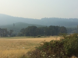
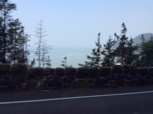
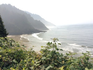
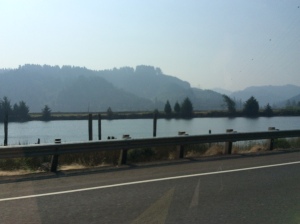 You can see how smoky the air is in the photos – but at least it gives a perception of depth and distance, as green hills fade to first dark then progressively paler grey.
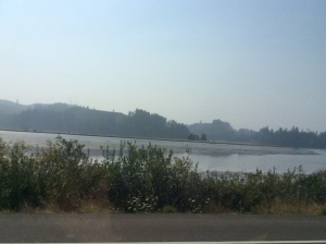 I’m hoping that once we reach the coast there will at least be a slightly fresher onshore breeze. The smoke has affected my breathing a bit and over the last couple of days I’ve used Ventolin for the first time on the trip.
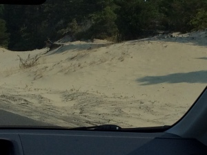 At Florence we turned onto the 101, heading north, initially with high sand dunes to our left. Even after five weeks here, more than three of them spent on the west coast, I still get confused about which way I’m heading. I have to keep forcing myself to picture the map – if the ocean’s on my left, I’m heading north!
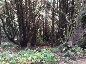
 Our first stop was the Darlingtonia Wayside Botanical Garden. There is a short, level trail under tall trees. It leads to a magnificent display of Darlingtonia Californica – carnivorous cobra lilies.
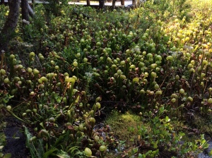 They are quite amazing plants (they really do look like cobras from some angles!) – and there are so many of them here! They grow in swampy areas in northern California and south-west Oregon – there must be a plentiful supply of insects in this spot because they’re both abundant and huge! Very impressive.
There were lots of other interesting shrubs, ferns and mosses along the trail too:
Back to the car to continue our drive along the coast (I love Route 101).
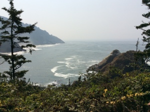
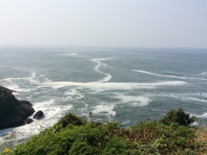
 The water is grey under the hazy sky and the road tracks along the steep clifftops and rocky headlands – the remains of ancient underwater magma flows that crashed into the coast as the Juan de Fuca Plate moved inexorably east. (I know a lot more about this now, thanks to Dennis at the Oregon University museum.)
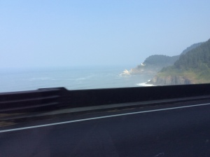 Some of the sedimentary rock that had settled above the volcanic eruptions was then eroded by the wind and waves, leaving the basalt exposed all along the coast. The dark coastal rocks are a striking sight for someone who comes from a place where the seaside cliffs tend to be golden sandstone! (It would probably look quite ordinary to a New Zealander!)
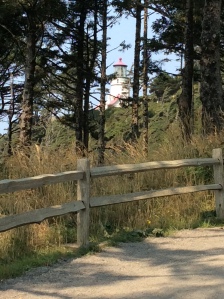
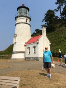
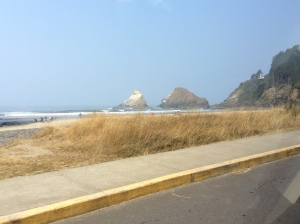
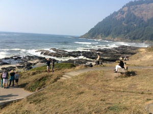
 Next stop was the magnificent Heceta Head Lighthouse, one of the forty or so lighthouses that line the West Coast, from Washington State through Oregon and Northern California, where the water is wild and cold and the coastline and ocean floor rocky and treacherous for shipping.
 Each light has a unique signature (Heceta Head is an amber flash every ten seconds) and these were formerly used for navigating – in fact they still are, especially by sailors of smaller boats, which don’t have the advanced technology of large commercial vessels.
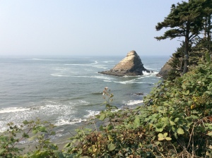
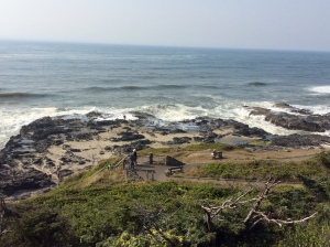
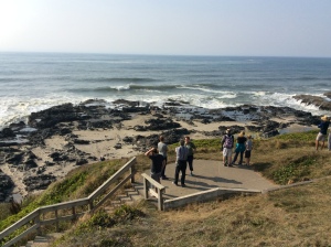
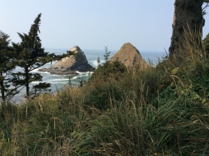 The lighthouse stands high on the northern headland of a small bay, with two rocky islands jutting out into the bay and sheltering a sandy beach. It’s a beautiful sunny day (despite the smoke haze, which has persisted a bit, even here) but no-one is in the water. I’ll find out why soon enough.
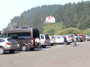
But first we decide to take the trail up past the old assistant lighthouse-keeper’s house (which is now an expensive B&B) to the lighthouse.
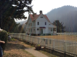 Sadly, the head lighthouse-keeper’s house was sold in the early 1900’s for $10 (with removal to be at the purchaser’s expense!) It was dismantled, moved and repurposed as a restaurant in Florence (Oregon), apparently! During WWII, there were army barracks on the site – these too have since been dismantled and taken away, leaving just the original assistant’s house with a fabulous outlook over the cove, the beach and the ocean.
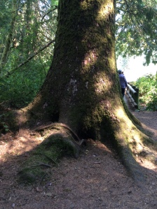
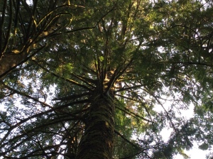
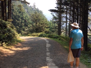
 The trail itself is pretty – a mix of cool winding pathway under tall mossy trees, and open trails along the side of the headland, following the old concrete path from the keepers’ houses up the light, with what we’d probably call coastal heathland on either side.
There were colourful flowers as well as blackberry bushes with some ripe fruit, which Roy sampled as we walked.
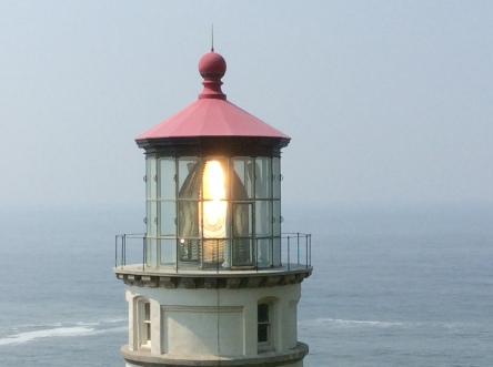
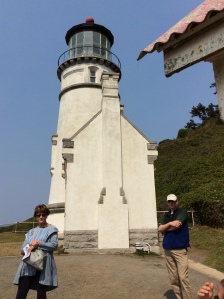 The lighthouse tower is relatively small as lighthouses go, but the light itself is powerful. You can see why it needs to be, when you look out to the wild ocean, with its tricky currents and channels.
It uses the largest English-made Fresnel lens in the US.
 All of the lights down the coast have a reach of about 21 miles, and they’re about 20 miles apart, to ensure some overlap for navigation.
 We stayed to hear the guide’s talk about the light and its keepers over the years before automation. It would have been a rough life tending the light in those days before Route 101! The wagons bringing supplies often had to race the tide around the headlands, and the storms would have been quite terrifying, I’d imagine. The pay was good for its time, reflecting both the importance of the lights in saving lives and the isolated conditions of the keepers and their families.
I can also imagine, though, that despite the isolation and physical challenges of the job, the sense of doing something really important and the closeness to the forest, the ocean and the weather would bring a sort of peace and satisfaction to the life of the keepers, provided they were temperamentally well-suited for the role. I can understand the attraction to it… “Sometimes, I need a lighthouse of my own…”
We walked a little further up the trail (that goes for miles on up the coast), until we were level with the light itself, and watched it going around and around, catching the light as it turned. Lovely. On the way back down, I spent a bit of time (and money) in the little gift-shop, which had some high quality merchandise, including locally-made wood carvings and crafts. Unfortunately (or fortunately, for my finances) we simply don’t have the room to take much back with us. The usual fridge magnets will have to suffice!
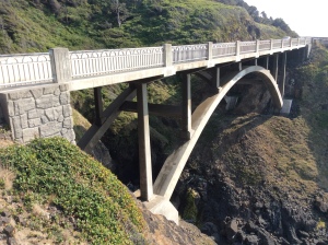
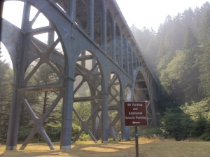 We ate our picnic lunch at a shady table not too far from where we’d parked the car, and in view of the graceful bridge that crosses the creek between the headlands on each side of the bay. There are several of these bridges up and down the coast – I really like them. Simple, solid and elegant.
 The sun was out by now but the onshore breeze was quite cool. The idea of swimming was not looming quite so large in my mind at this stage – but I thought that I should at least go down for a paddle, a token touching of this side of the Pacific 🙂
We walked down onto the beach – firstly over the river stones piled up near the mouth of the creek, then (after I removed my shoes) onto the crusty sand, a little courser than the sand of our Sydney beaches, and finally I stepped into the very shallow wash zone.
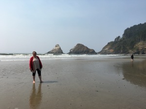 It was just past low tide and the beach is very flat here, so there was quite a wide section where the waves were just ripples, really, and the water that was only 2-5 cm deep. It was COLD! But not too bad, so I ventured further out to the next section, also quite wide, where the waves had a little more volume and the water was over my ankles.
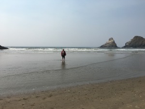 OMFG!!!!! It was like wading into an ice bath! I walked in a little further – O Jaysus, it was SO cold it actually HURT. I stood there for a perfectly respectable 10 seconds or so and then turned to make my way out. Roy called out “stop, stop!” – Lynnette was taking a photo – oh please, please take it, be quick, please, before my feet FALL OFF….
It was a relief to get back to the very shallow water, which felt like a warm bath in comparison. I marvelled that anyone who fell overboard or even fell off the shore into waist-deep water could survive. It was just paralysingly cold. The shock of immersion alone would probably do me in! So. That’s why no-one swims in the ocean on the Oregon coast. 😛
 Back to the car, with feet pretty much thawed out and reclad in warm socks and shoes, we headed further north to Yachats, to check out one of Lynn’s favourite coast walks, near a hotel that she and Barbara regularly go to for short breaks.
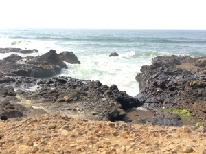
 The walk is fantastic – right along the top of the rock platforms that line the shore here. The surf is fairly calm today – but I can imagine it being terrifying in rough weather!
 They have king tides and storm tides that come right up over the path at times – the waves would be wild indeed.
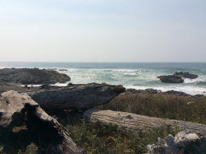
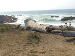
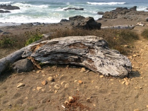
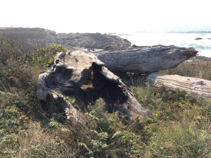 The huge driftwood logs that have washed up on the shore are testament to the power of the angry sea.
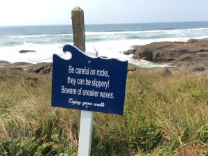
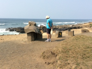 There is a memorial to two young men who drowned here when swept by a “sneaker wave” (what we’d call a freak wave – the kind that claims rock fishers in Australia) into a fissure between the rocks. The signs along the shore are a constant reminder of the danger. I suspect the bidding to “Enjoy your walk” is American politeness, rather than black irony.
 I shudder at the thought of such a terrible end, especially with my newfound respect for Oregon seawater. (I’ve always respected the ocean and its risks, having been brought up with it – but even at its coldest, the surf of the NSW coast is nowhere near the numbing harshness of what I felt today.)
 In one spot, the rock has eroded to form a channel with an arch over it, turning into a “blowhole”. The thump of the water as it works up to a big “blow” reminds me of the one at Kiama, which (on a good day) you can hear from the nearby camping ground – it rolls and crashes like thunder. Watching this one gives the same sense of anticipation (will the next blow be a good one?), awe (at the power of the relentlessly moving water) and vague unease (it’s so wild and unpredictable). We watch it for a while – I did my best to get a shot of a decent “blow”, but the tide is probably still a bit low for the full effect.
Back on the road, we drove a bit further up the coast to a much bigger inlet called the Devil’s Churn. This is much deeper, longer and narrower than the first one, and lies between two steep headlands. It gives a very clear illustration of the power of moving water to beat its way through any weakness it finds in the rocks on its shore, pushing deeper and further into the gaps between the higher ground on each side. It’s probably a glimpse of what the first one will look like in a few more thousand years!
I think Lynn was a bit disappointed in the fact that it was a relatively calm day and so this particular attraction wasn’t performing to its full potential. Never mind – I still found it incredibly impressive to watch the heave and churn of the water along the whole length of the chasm, and noting the pools of water above it that show just how high the spouts can go when there is more volume and movement behind them!
 Across another bridge to our northern-most stop: the Spouting Horn. This was amazing for two reasons. One, the Spouting Horn itself, which is another blowhole, but unlike those we’ve seen today, it “blows” through a hole in the rock platform, under which the water has eroded a cave. The “blow” can be a spout of actual water spray, but more frequently takes the form of spray so fine it appears as water vapour, reminiscent of the “blow” of a whale! It’s pretty awesome!
We followed the trail down to the next viewing spot, but we were all getting tired and decided not to venture further down to the rock platform.
 There were several people down there, though (way too close to the edge for my liking), some with cameras on tripods. There is another formation at the edge of the rock platform that causes interesting water flow patterns.
 Lynnette assumed that they were watching and photographing that, but Roy wondered why they seemed to be looking out to sea. He started looking out there too, and sure enough, there was the second amazing sight: a whale!
 Unfortunately it was a bit too far away for iPad photography. We saw it blow several times, and caught glimpses of its head and back as it swam close to the surface. Then it dived and disappeared for a while, but popped up again a little closer to the shore and swam around near the surface again for a few minutes. Fantastic! Again, a few great plumes from its blowhole and then another dive… we watched it repeat the whole sequence four or five times before heading back to the top of the trail, as it was getting late and Lynn wanted to be home before dark. What a wonderful way to finish our mini-tour of the Oregon coast!
We returned to the car and started the drive home, very satisfied with the day’s adventures and sights. I have all sorts of plans for our *next* trip, including camping and road tripping Routes 101 and 1, all the way between Washington (State) and Southern California…
There were plenty of leftovers from last night for dinner when we arrived home, supplemented with a few bits and pieces we picked up at the supermarket on the way back. It was a wonderful day, but we were very conscious of our time together coming to an end soon, so we stayed up quite late talking and just keeping company together. I will be so sad to leave here, and I’m fighting off the signs of the “going home” anxiety – going back to the same old stuff, going back to work, going back to the confined spaces of a house in Gladesville. I am looking forward to seeing Lou and the family though, and our choir friends. There are good things ahead too!


 Some of the disagreements over dates were settled through an appeal to the photo record. I mentioned that I hadn’t seen any pictures of Roy as an adult without a beard. Lynn didn’t have many, but there were a couple from her wedding day (unfortunately he had his eyes closed in the formal one!).
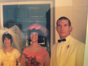 There is a very handsome chap lurking beneath that beard! At least now there’s a chance I’d recognise him if he ever shaves it off, as unlikely as that might be, since he’s had it for over 40 years now! I commented in an earlier post about some of the photos of Roy as a child, and his lovely open face and smile. Now I know that he took that look with him into adulthood. Thanks Lynn!


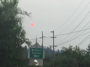 After dinner we took off in the gloom of what should have been sunset (the smoke had turned the sun to a pink disc low in the evening sky) and soon arrived at the dance venue – a gym by day but a good venue for dancing by night, a nice timber dance floor and plenty of room. We were greeted by Sally and her husband Alan, who were setting up for the evening, and soon met Janet, who had responded to the email I sent a few days ago. They and the other people we met were very welcoming and friendly – the folk dance community is pretty cool!!
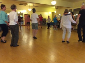 They did a few slowish warm-up dances, some of which Roy knew. I did a couple with them, and I think picked them up not too badly! (These are difficult times…)
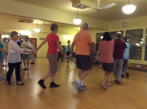 Then Janet taught a couple of new (to the group) Macedonian dances – the first one I could possibly have done with practice but it did have a bit of jumping in it and I thought it was best not to try it with the music in case it was a bit fast (it would have been). My fused left ankle doesn’t flex of course, so I’m a bit wary of putting too much strain on that foot – it can’t really make up for the lack of “spring” in the ankle, and you need that for jumping.
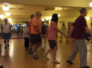 From 8-9.30pm they do requested dances. Sally was running this tonight and went out of her way to ensure that our requests were included on the dance list for the evening – we really appreciated this, and it made us feel very welcome!
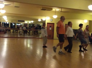 Roy actually led a couple of dances, which was good, and he knew quite a few of the others they did, even though they do some of the steps a bit differently. One that he led has a lot of fancy footwork in it – you’ll have to find the video on Facebook when I get around to posting it! I danced just a few of the slower ones – I requested Cobankat of course, which is my favourite. 🙂
 They really are terrific markets – so much there to look at and to agonise over whether I can fit it in my luggage or not!
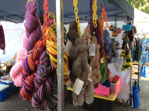
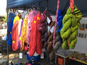 OK, four things. I know, I know, but they were hand-dyed and will make beautiful shawls. Shut up.


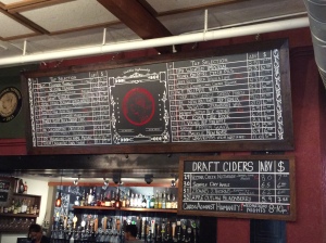 The waitress was very friendly and we chatted to her for a bit, as the bar wasn’t busy. She gave us some advice about the various beers on offer – I’d never heard of most of the brands! Lynnette had a couple of tasting pours of pale ales before making a decision, and Roy tried a couple of ciders, choosing one with (I think) a blackberry blend (OMG!! THATS NOT CIDER!!!!) over another that was so dry it barely wet his throat on the way down 😉 I had a rather good stout, that was rich, smooth, a little bit creamy and not too muddy, and SERVED COLD!
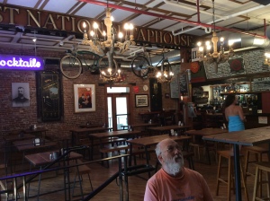 The fact that I was drinking stout almost put me off my first preference for lunch – pesto and vegetable linguine – because they didn’t really seem to go together.
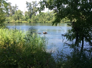 After lunch, we drove down to the Willamette River where there is a trail that follows the river and a very popular bike path. Keeping off the path as much as possible is kind of desirable, because of the high level of bike traffic, so we ducked down to the river trail and followed that a little way.
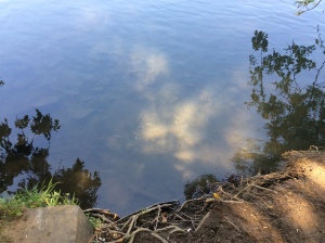 Although it was lovely to walk near the river, the constant growl of traffic from the Interstate highway on the other side of the river detracted a bit from its charm.
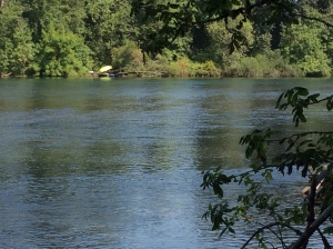


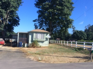 The houses here are mostly timber – not so much because of shaky ground (although that does happen) and building regulations (although I’m sure they have them) but because in Oregon, timber has traditionally been both plentiful and cheap as building material (ever heard of Oregon pine? – well, it’s called Douglas fir here – and it’s not a true fir either. But I digress…) I like this contrast of traditional older country house with the modern addition of a satellite dish for TV reception!


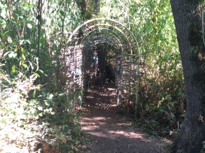 Donors have raised money to commemorate people who contributed to the arboretum – the wetlands exhibit includes a couple of these memorial structures.
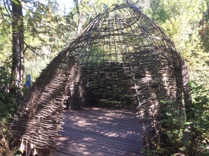 The first we came to is a lovely woven-stick “tunnel” leading to a similarly constructed dome “hide” with observation windows and information about various fauna and flora, and a little observation deck.
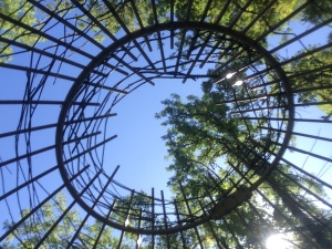 When the water is flowing well, it must be really lovely spot for observing but at the moment it’s quite overgrown.
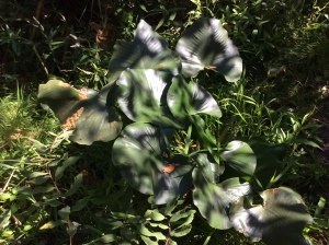 Still, it was good to sit and watch for insects and birds, to read the information and to imagine what this might look like in springtime when the water runs higher.

 We stood on the bridge for a long while, hoping to see something – anything – as we’d been a bit disappointed at the lack of typical wetland creatures at the earlier dome and observation point.
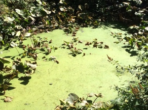 Nothing moved in the swamp below, although the occasional turkey vulture cruised overhead, and a crow called somewhere near us.
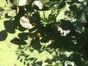 There was just one bright yellow lily flower in the pond, contrasting with the lime green of the tiny plants or mosses covering the surface.
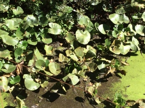
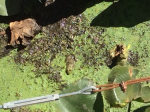 Then suddenly Roy spotted a frog, mostly submerged in the water (or mud), keeping nice and cool in the now-quite-hot sun, just below where we were standing on the bridge. You could see its head and snout, and a bit of its back, and a rough outline of its body and legs just below the surface.
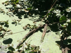


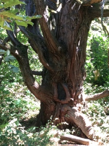 The “Octopus Tree” is now roped off – it’s been loved to death by people wanting photos sitting in and around it, resulting in compacted soil and damaged boughs – but it’s still possible to get pics of this very full-of-character gnarled old man.
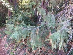 And then there are the young ones of course…


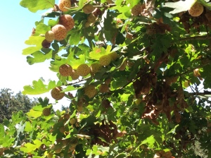 There are some beautiful old oak trees in the meadow, as well as some new saplings coming through along its edge and on the other side of the trail. One young tree had hundreds of weird globules of different sizes on it, some on the leaves and others attached to branches and twigs.
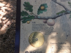 They were easy to pull off the leaves, almost as if they were stuck on with light velcro. We had no idea what they were – the smaller ones were yellowish-grey but the larger ones were pale yellow with reddish spots. Quite intriguing! A bit further down the trail, we found the explanation.


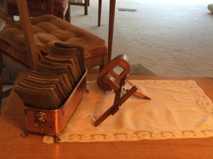 We were fascinated to find a wooden “stereoscope” on display at a side table. Roy remembered his Aunt Catherine having one – and this is the very same one!!
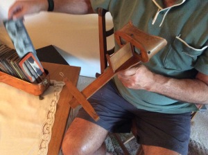 This is not all that surprising, since Aunt Catherine was Barbara’s mother – but amazing to find it here when Roy can’t have seen it since he was a little boy!
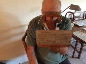 Barbara also has a full box of pictures for viewing with it – and she was happy for us to try it out. It was amazing – such a simple thing and yet so effective at creating a very realistic 3-D picture. What a gorgeous thing to have!
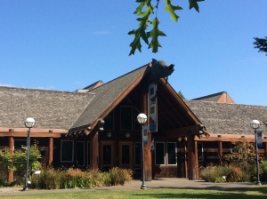 We got organised and headed off to check out the museum.
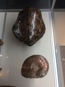
 It’s only fairly small, but it was really, really good – excellent (if somewhat eclectic) exhibits and very informative interpretation of objects, natural phenomena and the interaction of human beings with the planet.
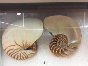
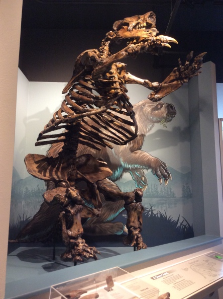


 One of these rooms was devoted to an exhibit about wolves, the role they play in ecosystems, and the controversy over whether they should be reintroduced to parts of Oregon, in the hope of bringing about a similar regeneration of the natural environment as was achieved in Yellowstone National Park (there is a good video about this, which I am happy to recommend now that I’ve seen it in a proper university science museum and not just on YouTube).


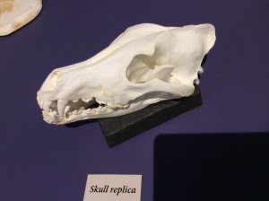
 This exhibit also helped me solve another mystery – it included examples of scats, and I reckon the one I saw at Reelfoot Lake matched the coyote pretty well. But apart from an unlabelled photo on the Reelfoot Lake State Park website, I can’t find any confirmation that there ARE actually coyotes there.

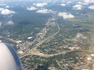
 And after a while, the lush green of Tennessee and Missouri gave way to still-fertile but more tamed landscapes: flat, agricultural land carved into fields and farms.


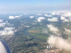
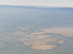 And suddenly, there was the Bay, the Dumbarton Bridge, San Mateo Bridge and the Bay Bridge in the distance,
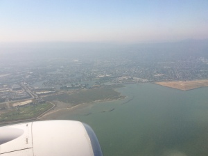 and we were coming in to land and taxi-ing to the gate, only a little bit later than expected.
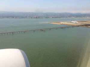


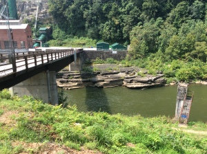 We’d been to Twin Falls on our last trip, but it’s always worth another look. It’s a fantastic set of falls, just downstream what was the confluence of two rivers.
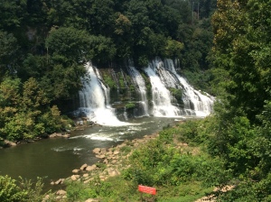 When one of the rivers was dammed to create hydro power, the water trapped in the reservior above forged a new path through the caverns and cracks in the rock of the riverbanks (I think it’s mostly limestone – there are caves nearby).
 We walked along the track beside the river a little way, to find a good vantage point for photos of the falls.
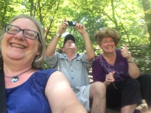


 We found a spot where we could step down some rock shelves to get a bit closer to the falls and out of the overhang of the trees along the track.


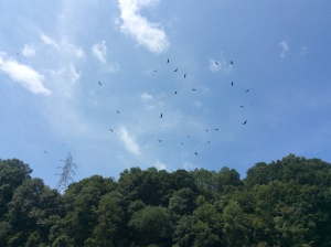 We made our way back over the track and the 60 steps up to the car for the next leg of our journey. As we turned back for a final look, Roy noticed the soaring birds above – turkey vultures (or buzzards), and some crows.
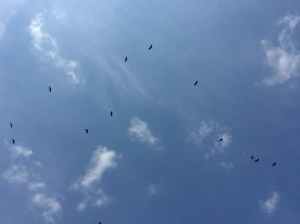 There were stacks of them circling overhead! Just like in the movies after a gunfight or a battle 😉 We all checked our vital signs to make sure we weren’t the ones they were after (they are carrion feeders) and made good our escape.
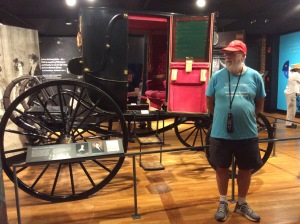 There was lots of interesting info there, as well as artefacts from Jackson’s time. Obviously I’ll need to read the book Sue gave us about him, because in this short tour there was way too much to get my head around! He was certainly an expansionist, energetically advocating for the theft of land from native Americans (although he didn’t call it that, of course). He clearly loved his wife and family dearly. He was a strong supporter of the Union, and of the primacy of Federal law over State law. His grandsons, however, fought on the Confederate side in Civil War. He was an extraordinary military leader and strategist.


 The garden also contains the small family graveyard. Jackson’s adopted son and his wife are buried there, and their children. The youngest grand-daughter, also called Rachel, had nine children, six of whom also lie there (as far as I can make out, anyway).
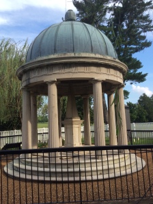 Next to the graveyard is the tomb Jackson had built for himself and his beloved wife, Rachel, who predeceased him by many years, dying only a couple of weeks after he won his first presidential election.
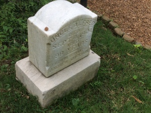


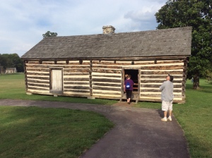 Of course, what has not been preserved, but to the Museum’s credit is brought to the attention of visitors by the guides, are the rough mats on which the slaves slept in the corridors outside the family bedrooms, at the beck and call of their “masters”. Hideous. In the slaves’ hut where Uncle Alfred lived it is permitted to take photos – nothing special, valuable or worth owning copyright over in there.

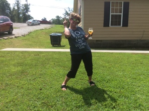 We divided our time from then on between watching the TV, watching the clouds and watching Sooze drink Margaritas. 😉
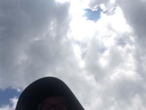 The rain stopped, but the clouds kept coming.
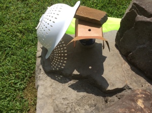 There were tantalising breaks of bright sunshine (which allowed us to get a pinhole projector and a colander – yes, a colander) set up.
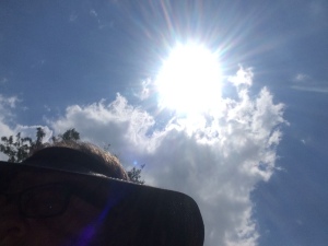
 First contact for us was just before 12 noon – we were all out in the yard for this, glasses poised, with the sun just about to emerge… and then it was there, full in the sky, and the event had started. At first we couldn’t see much, but after a few minutes I risked a quick left-eyed look through the glasses and there was a clear indent in the circle of the sun. Very exciting!
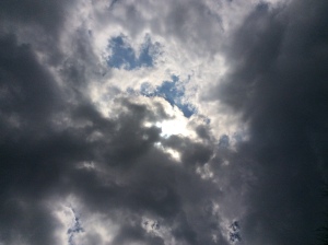 We had another ten or fifteen minutes of sunshine before 1pm, and so saw the eclipse progress from about 40% to about 60%, when the light began to dim noticeably, then again we lost sight of the show.
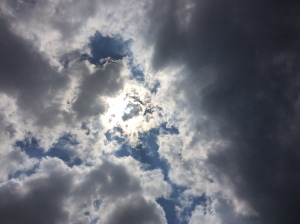
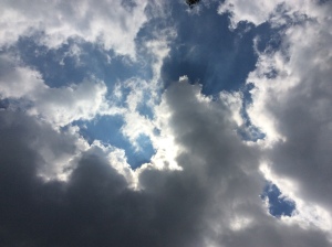
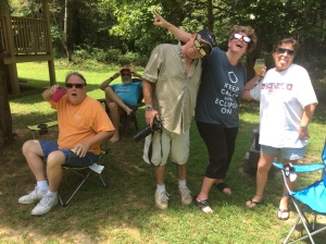
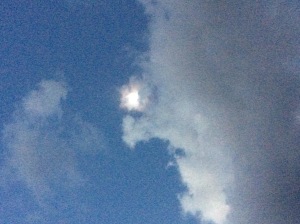 And then… only two or three minutes before totality, the sun shook off the cloud and we could see it – a tiny sliver of bright orange through the glasses, almost like a new moon – we couldn’t believe it!!! We cheered and whooped and watched and held our breath – there was a patch of blue sky between the clouds and the sun was moving into it, the cloud was almost like a frame around the sun! PERFECT!
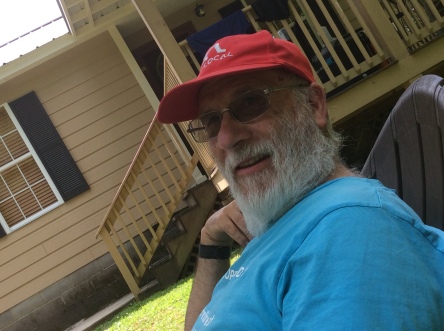
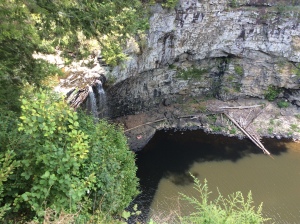
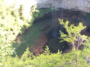
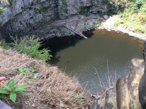 We went to Cane Creek Falls first and took some photos. If you look carefully in some of the pics, you can see people right down the bottom, in the deep pool at the foot of the falls.
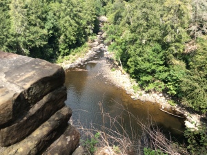


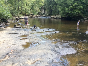
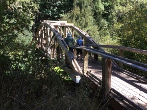
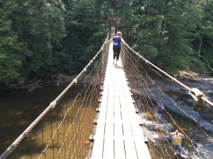 Roy and I didn’t stay long at the pool – we didn’t want to hold everyone else up – but when we got back to the top and found Sue and Dean again, they said that Hal and Teri had decided to go back to the cabin and would meet us there for dinner. So the four of us took a walk across the bridge and back. It is a little unsettling, but it wobbles less if you walk on the middle board. It was fun! And you get a lovely view of the swimming holes in the cascades below.

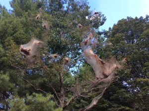 Something I’d forgotten from last time was the big basket-like webs hanging on some of the trees.
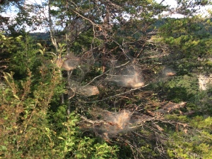 At first I thought they were spiders, but they’re not – they’re small parasitic “bag worms” that attack a tree by spinning these webs and, I assume, feeding off the tree sap (must look that up!)
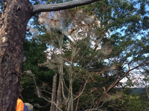 They do eventually kill the tree. Dean said that they’ve been particularly bad this year – and we have certainly seen plenty of them about as we’ve been driving and walking around.
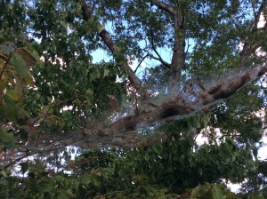
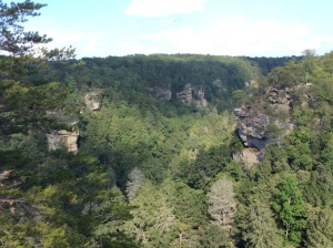
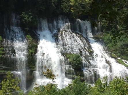
 We stopped to look at the main Fall Creek Falls nearby. The outlook here is grand, and a bit reminiscent of the Blue Mountains, the way the layered sandstone cliffs jut out above deep valleys.